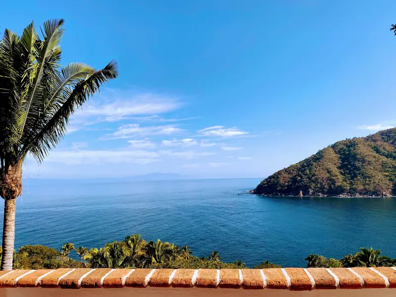
Yelapa is a small fishing village on the mainland coast of Jalisco, Mexico, in a cove on the south shore of Banderas Bay. It isn't an island and it isn't part of Puerto Vallarta, but there's no road in, so you arrive by boat, about 30 minutes by water taxi from Boca de Tomatlán at the south end of Puerto Vallarta.
That boat-only arrival is why so many people picture an island. Here's how the pieces fit together, from the airport to the beach.
Is Yelapa an island?
No. Yelapa sits on the mainland, in the southernmost cove of Bahía de Banderas, where the foothills of the Sierra Madre meet the sea. The island feeling comes from the access: the town has no road big enough for regular cars, and the local transport site says there's no viable way in by land. Mules carry goods through town, and everyone else walks.
Is Yelapa part of Puerto Vallarta?
No. Yelapa belongs to the municipality of Cabo Corrientes, the westernmost municipality in Jalisco, whose seat is the inland town of El Tuito. Puerto Vallarta is a separate city in the same state.
People often say "Yelapa, Puerto Vallarta" because Puerto Vallarta is where you land, where the boats leave from, and where you find banks, big grocery stores, and full hospitals. Mexico's 2020 census counted 882 residents in Yelapa, and its first families blended Indigenous, Spanish, and Afro-Mexican roots.
Where is Yelapa on Banderas Bay?
Banderas Bay lies in the states of Jalisco and Nayarit, with Punta Mita marking its north end and the cape of Cabo Corrientes marking its south end. Its coastline runs about 100 kilometers. Puerto Vallarta is on the bay, and the south shore runs from Boca de Tomatlán toward the cape, with Yelapa near the far end. If you want to drop a pin, Yelapa sits at about 20.49° N, 105.45° W.
Key places between the airport and Yelapa
| Place | What it is | Why it matters for Yelapa |
|---|---|---|
| Puerto Vallarta International Airport (PVR) | The airport in the Puerto Vallarta urban area, about 1 km north of Marina Vallarta | Where most visitors fly in |
| Los Muertos Pier | The pier on Los Muertos beach in the Romantic Zone | Water taxis to Yelapa, at least 55 minutes |
| Boca de Tomatlán | A small town at the south end of Puerto Vallarta, where the coastal road meets the boats | Water taxis to Yelapa, about 30 minutes, with more and later departures |
| Las Ánimas, Quimixto, Majahuitas | Boat-access beaches and villages between Boca and Yelapa | Easy add-ons for a beach day |
| Cabo Corrientes | The cape at the bay's south end, and the name of Yelapa's municipality | Why you see "Cabo Corrientes" on maps and addresses |
For a visual layout of the beach, town, river, and trails once you arrive, see our Yelapa map guide.
How far is Yelapa from Puerto Vallarta by boat?
The water taxi from Boca de Tomatlán takes about 30 minutes. The ride from Los Muertos Pier takes at least 55 minutes. From the airport, allow at least 30 minutes by car to Los Muertos or at least 60 minutes to Boca before you even board, based on the minimum times go2yelapa transport lists.
Water taxis run several times a day in both directions, from morning into early evening, and times can change with the weather. Plan to arrive in daylight. If your flight lands late, book a hotel night in Puerto Vallarta and take a morning boat. Our boat guide compares the options, and the ferry guide covers the newer ferry.
Which airport do you fly into for Yelapa?
Fly into Puerto Vallarta International Airport, code PVR, officially Licenciado Gustavo Díaz Ordaz International Airport. From there, take a taxi to Los Muertos Pier or Boca de Tomatlán and continue by boat. Our airport-to-boat guide walks through the steps.
What time zone is Yelapa in?
Yelapa uses Mexico's Zona Centro (Central Time), UTC minus 6, all year. Mexico's 2022 time zone law placed most of the country, including Jalisco, in Zona Centro and dropped daylight saving time everywhere except some northern border areas.
The law also keeps the Nayarit municipality of Bahía de Banderas, on the same bay, on Zona Centro, even though the rest of Nayarit uses Pacific time. That means Yelapa, Puerto Vallarta, and the airport all share one clock. A few older web pages still list an outdated offset for Yelapa, so trust your phone once it connects to a Mexican network.
What villages are near Yelapa?
Several small beach communities line the south shore between Boca de Tomatlán and Yelapa, and you reach them by boat:
- Las Ánimas: a beach reached by boat from Boca, the closest of the three to Puerto Vallarta.
- Quimixto: a village where horses meet visitors on shore for the ride to Quimixto Falls.
- Majahuitas: a small cove reachable only by sea, good for swimming and snorkeling.
Our guide to day trips from Yelapa covers how to visit them.
FAQ
Can you drive to Yelapa?
No. There's no road for regular cars, so everyone arrives by boat from Boca de Tomatlán or Los Muertos Pier in Puerto Vallarta.
Is Yelapa in Jalisco or Nayarit?
Yelapa is in Jalisco, in the municipality of Cabo Corrientes. Nayarit is the bay's other state, home to the municipality of Bahía de Banderas.
Do I need to change my watch between Puerto Vallarta and Yelapa?
No. Both are on Zona Centro, UTC minus 6, all year, with no daylight saving time.
How big is Yelapa?
Mexico's 2020 census counted 882 residents in the Yelapa locality (local estimates for the wider village run around 1,500), spread along the beach, the river, and the hillsides above the cove.
Checked October 14, 2026. Details change, so confirm with the sources below before you go.
Sources
- Cámara de Diputados, Ley de los Husos Horarios en los Estados Unidos Mexicanos (PDF)
- Wikipedia, Yelapa
- Wikipedia, Banderas Bay
- City Population, Cabo Corrientes localities, INEGI 2020 census
- Wikipedia, Cabo Corrientes Municipality
- Wikipedia, Licenciado Gustavo Díaz Ordaz International Airport
- Mexico News Daily, A guide to Yelapa, Jalisco
- VillaRental, Beaches south of Puerto Vallarta
More in our Yelapa visitor guide.
Plan your stay
Casa Gratitud sits on the hillside above the bay at the point, with three levels of terraces facing the water. Our host family meets you at the pier when your boat comes in. See the house at yelapacasagratitud.com or check rates and availability.